Portfolio
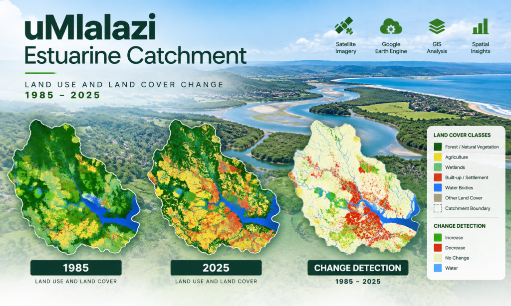
uMlalazi Estuarine Catchment
Land Use & Land Cover Mapping | 1985–2025
We undertook multi-temporal land-use and land-cover mapping, validation, change detection and spatial visualization for the uMlalazi estuarine catchment.
Using Landsat imagery, Google Earth Engine, GIS and ESRI Story Maps, the project examined changes in vegetation, wetlands, agriculture, settlements, water bodies and other human activities over four decades.
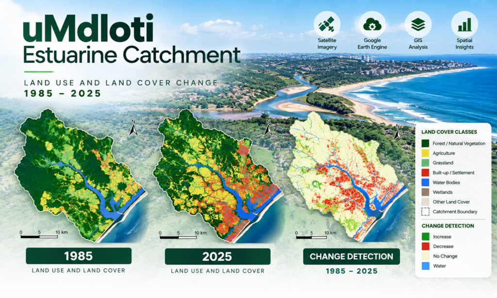
uMdloti Estuarine Catchment
Multi-Temporal LULC & Change Detection
Zuri Geospatial worked on land-use and land-cover mapping, validation and change detection for the uMdloti estuarine catchment using multi-temporal satellite imagery and geospatial technologies.
The work provides historical spatial evidence that can support environmental monitoring, catchment planning and understanding of ecosystem changes. Zuri Geospatial
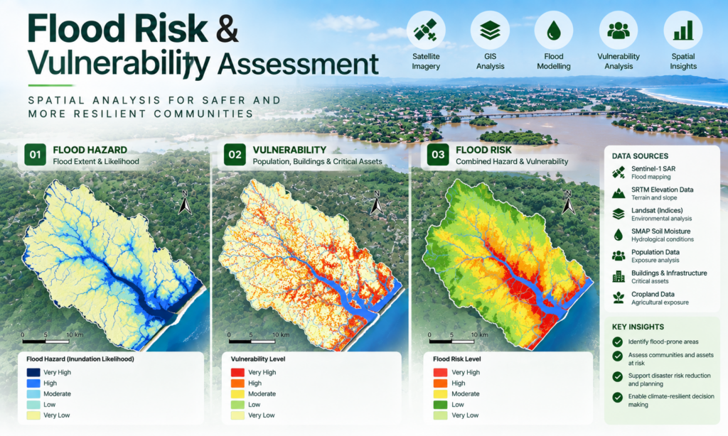
Flood Risk & Vulnerability Assessment
Our geospatial analysis integrates remote sensing, GIS and multiple spatial datasets to understand flood hazards and vulnerability.
The documented work incorporates Sentinel-1 SAR, SRTM elevation data, Landsat-derived indices and SMAP soil-moisture data, combining hazard information with population, buildings and cropland to support spatial vulnerability analysis.